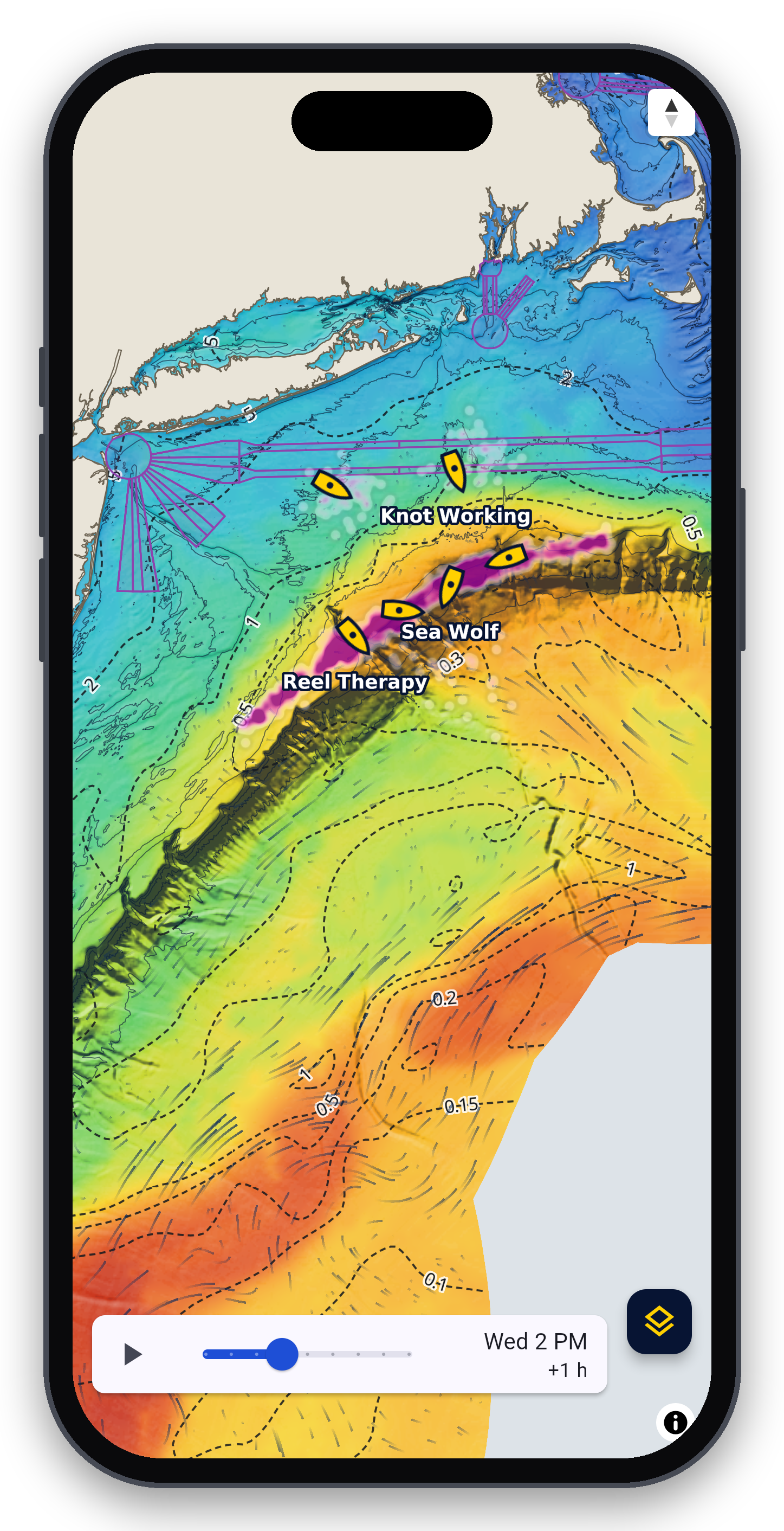

Offshore fishing intel for the US Atlantic, Key West to Maine. Fishing-grade canyon relief, daily SST and chlorophyll, altimetry, currents, waves, weather, and live fleet tracking on one chart, on your phone and offline offshore.
Features
Charts and structure
In-house canyon relief shading from NOAA multibeam and GMRT bathymetry
Depth contours in fathoms, feet, or meters
Fishing zones: nearshore, midshore, canyon
NOAA chart detail: wrecks and obstructions, soundings, buoys and lights, restricted areas, shipping lanes
Water conditions
Sea surface temperature, daily and cloud-free, with adjustable color range and isotherm lines (°F or °C)
Chlorophyll (water color and clarity) with break lines
Altimetry (sea level): eddies and Gulf Stream edges
Currents with animated flow, 48-hour forecast
Waves: height, direction, and period, 72-hour forecast
Daily temperature and color break detection, with a 1 to 3 day break forecast
Weather windows
Wind and gusts, 48-hour hourly forecast
Rain and lightning, fog, clouds, pressure
Live NOAA buoy reports
Forecast time slider with playback
Fleet tracking
Commercial AIS, including satellite coverage of the canyons
Member boats shared from the Hundred Fathom app or BoatSense by BilgeBuddy integration.
Fleet activity heatmaps and day-to-day fleet movement
Fleet forecast: where the fleet is likely to be tomorrow
Your boat, your choice: show it by name (delayed or live) or only in the totals
Fleet alerts by push and email
Renewal credits
Share your qualifying offshore trips: 15% off renewal for 3+ months, 25% off for 6+ months
Trip planning
Tap anywhere for depth, SST, chlorophyll, current, wind, and waves, plus a spot forecast
Trip Day: tides, tidal currents, first and last light, sunrise and sunset, moonrise, moonset, and moon phase
Coverage from Key West to Maine, out to 200 nm
Everywhere you fish
iPhone and Android apps
Offline chart and data packs for running beyond cell coverage
Web app on desktop and tablet for planning at home
Fine print
Annual subscription. Sign in to the app with the same email you use at checkout.
Not for navigation. Use official NOAA charts and your vessel's instruments.
Data: NOAA, NASA JPL (MUR SST), E.U. Copernicus Marine Service, GMRT.
No results match your search. Try removing a few filters.
